Dartmouth Multifamily Builder: Reading the Zoning Map Without the Manual
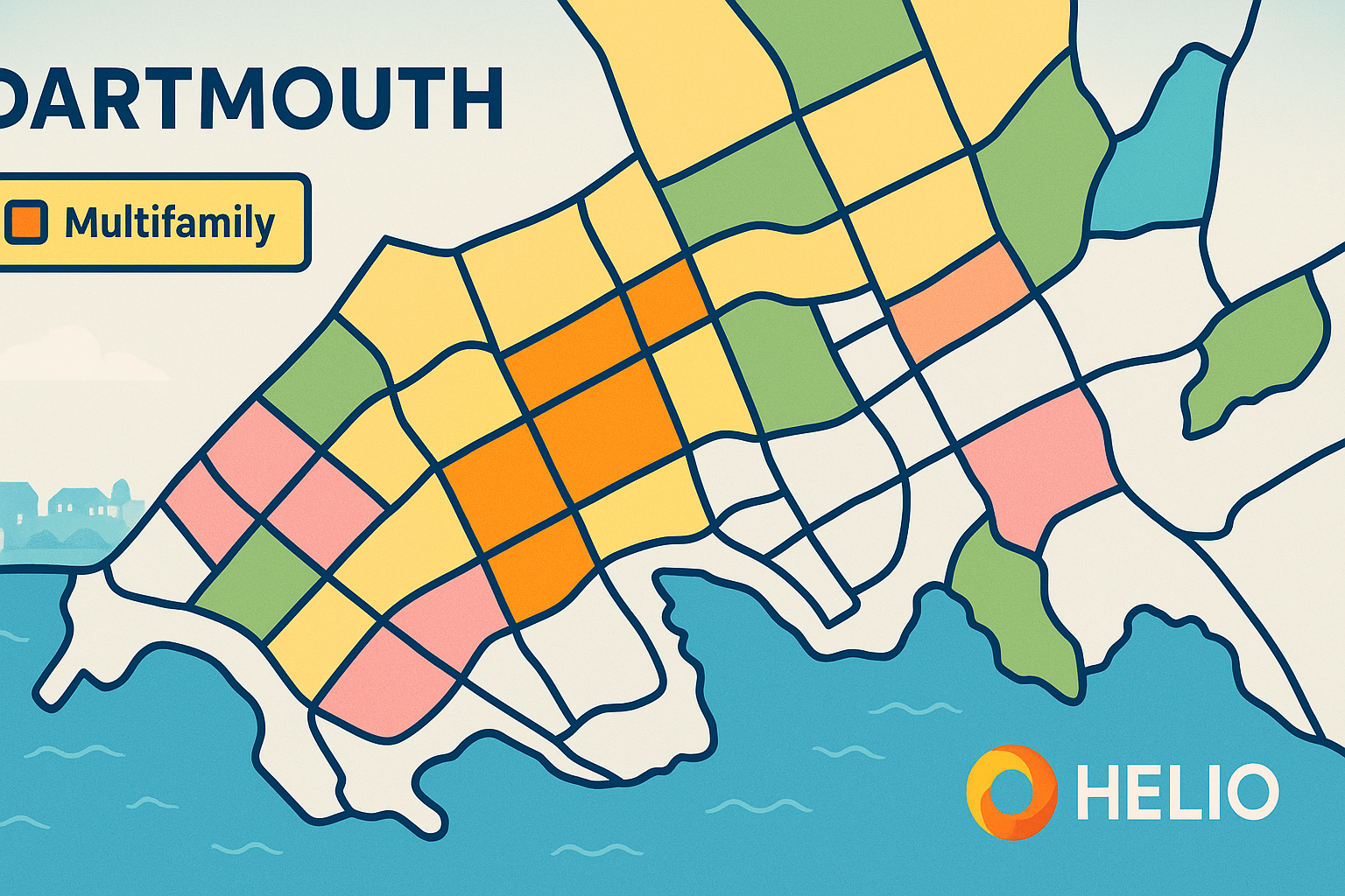
Navigating Dartmouth’s zoning maps can significantly impact your multifamily development projects. Recent updates, like the Centre Plan and 2024 amendments, have introduced changes such as increased unit allowances in ER-3 zones and reduced parking requirements (1 space per 3 units). These adjustments aim to boost housing capacity, with 71,000 new units possible in the Regional Centre. Key takeaways:
- Zoning Maps Matter: Misreading them can lead to costly delays. For example, ER-3 zones now allow up to 8 units instead of 4.
- Centre Plan Updates: Heritage conservation areas have expanded, and parking minimums have dropped.
- Tools to Use: ExploreHRM and the Centre Plan Interactive Map provide zoning details and simplify planning.
- Avoid Mistakes: Check overlay zones (e.g., heritage or flood areas), confirm current zoning rules, and account for parking and density limits.
To streamline the process, collaborate with design-build firms that handle zoning and construction under one contract, minimizing risks and ensuring compliance.
How To Read A Zoning Map? - CountyOffice.org

Zoning Classifications and Map Tools
Understanding Dartmouth's zoning system and available tools is essential for identifying multifamily development opportunities. The zoning map organizes areas by residential density and land use, serving as a guide for what can be built where. To get started, consult official documents for the specific rules and regulations tied to each zoning category.
Zoning Categories for Multifamily Development
Dartmouth's zoning map outlines various residential zones, each supporting different scales of multifamily housing. These range from low-density zones to areas designed for larger developments. In the Regional Centre, for example, zoning details include building heights, setbacks, and design standards. To determine what’s permitted in a specific area, property owners should refer to the Land Use By-law and other official documents for precise unit limits and development guidelines.
How to Access Dartmouth Zoning Maps
Once familiar with the zoning categories, you’ll need to verify your property’s zoning using official maps. Digital tools like ExploreHRM and the Centre Plan Interactive Map make it easy to locate zoning details and development parameters.
- ExploreHRM: This interactive tool allows users to search land use zones by entering an address, street name, or community. It provides up-to-date zoning and development information for properties across the Halifax Regional Municipality [2].
- Centre Plan Interactive Map: If your property falls within the Regional Centre, this map offers detailed, area-specific zoning information. It also includes Centre Plan Zone Fact Sheets, which simplify land use regulations, saving you from sifting through lengthy bylaw documents [3].
For official documentation, the Halifax.ca website provides downloadable PDFs of zoning maps and related resources. For instance, the "Schedule 1 - Zoning Map for Dartmouth [PDF]" is part of the Land Use By-law for the Dartmouth Plan Area and provides a comprehensive zoning overview [1]. Additionally, the full Municipal Planning Strategy [PDF] and Land Use By-law [PDF] documents contain detailed regulations for each zone [1]. Keep in mind that these electronic resources are for reference only, and it’s wise to confirm details with official sources as amendments might not be immediately reflected [1].
Reading Zoning Map Elements
Accurate interpretation of zoning maps is key to making informed development decisions. These maps use a combination of colours, symbols, and overlays to convey property information. Zone boundaries are marked by distinct colours, with a legend explaining which colours correspond to specific zones.
Overlay zones, often represented by hatched patterns or additional symbols, highlight special designations like heritage conservation areas, flood zones, or environmentally sensitive regions. In Dartmouth, for example, heritage overlays are common in historic neighbourhoods such as Downtown Dartmouth and the Flower Streets.
Other critical map elements include lot lines, property boundaries, setback lines, and building envelopes, which help define where structures can be placed on a parcel. Street classifications, shown on the map, can also impact access requirements and development potential. Lastly, scale indicators and north arrows assist in understanding distances and orientations - important for planning density, parking, and building placement. Interpreting these details correctly is essential for making practical development decisions.
Finding Development Opportunities for 4+ Unit Properties
Once you're familiar with Dartmouth's zoning categories and the digital tools at your disposal, the next step is identifying properties with potential for development. Success hinges on more than just zoning permissions - you'll need to consider factors like site size, density allowances, and local regulations that dictate what can actually be built. From there, it's all about matching property attributes to the zoning guidelines.
Choosing Properties for Multifamily Development
When evaluating a property's potential for multifamily development, lot size and frontage are crucial. Zoning rules set the standards for building types, height limits, lot dimensions, and the maximum number of units allowed [4]. Properties that stand out typically offer enough space to accommodate a building footprint while meeting setback requirements.
It's also essential to examine the capacity of local infrastructure. Higher-density developments often come with stricter regulations. If a property isn't zoned for multifamily use, you might need to pursue rezoning or apply for a special use permit. These processes usually involve submitting a detailed site plan and participating in public hearings [4].
Working with Form-Based Code and Density Limits
Understanding zoning maps goes beyond identifying zones - it also means grasping density limits and design guidelines, which shape your buildable area. Density determines how many units you can build, and high-density zones often come with additional requirements, such as parking provisions or designated greenspace [4]. Design guidelines may also dictate building heights, setbacks, and architectural styles, which can influence both the number of units and the project's overall design.
To define your buildable area, you'll need to carefully review restrictions like setbacks, height limits, and lot coverage. Consulting with a zoning attorney or urban planner can help clarify these often-complex regulations and ensure your project aligns with local standards. These zoning considerations lay the groundwork for successful developments, as illustrated in the examples below.
Real Examples of Zoning Success
By combining effective map reading and property evaluation, real-world examples highlight how zoning can be leveraged for profitable development. For instance, mixed-use projects can significantly enhance the potential of multifamily developments [4].
Local governments play a key role in setting and enforcing zoning rules, which typically cover aspects like building height limits, minimum lot sizes, and parking requirements [4]. A deep understanding of these local variations, paired with strategic planning, can unlock opportunities for successful multifamily projects.
sbb-itb-16b8a48
Common Zoning and Development Mistakes to Avoid
Getting zoning right from the start is essential to keeping your development project on track and avoiding unnecessary expenses. Many property owners run into trouble by misinterpreting zoning maps, which can lead to delays and increased costs, especially in multifamily developments.
Top Zoning Map Mistakes Property Owners Make
Misunderstanding overlay zones is a costly error. A property might seem suitable for multifamily development based on the primary zoning map, but overlay zones - like flood zones, heritage districts, or environmental protection areas - can impose extra restrictions that limit what you can build.
Always rely on the latest zoning information. For example, Dartmouth's Centre Plan introduced updates to zoning classifications. Using outdated maps or regulations could result in planning a project that violates current rules. To avoid this, always consult Halifax Regional Municipality's official website for the most up-to-date zoning data.
Ignoring parking and amenity requirements is another common oversight. Different zoning classifications often have specific mandates for parking spaces and amenity areas, which can inflate construction costs if not accounted for early in the planning stage.
By avoiding these mistakes, you can better appreciate the advantages of a more streamlined and integrated approach to development.
Fragmented Construction vs Integrated Design-Build Costs
Zoning errors can snowball into broader construction challenges, particularly when using traditional construction methods. In a fragmented approach, property owners often hire separate architects, engineers, planners, and contractors. This setup can lead to conflicting interpretations of zoning regulations, resulting in design revisions that inflate costs - sometimes by as much as 30% to 60%.
When different teams check zoning compliance at various stages, inconsistencies are bound to arise. For instance, issues like setback violations may only come to light during the building permit application process, forcing expensive redesigns that could have been avoided with better coordination.
Fragmentation also creates accountability gaps. With multiple contracts, no single party is responsible for ensuring zoning compliance throughout the project. Miscommunication between your architect and contractor, for example, can lead to changes that inadvertently violate zoning rules, leaving you to mediate between unaligned professionals.
An integrated design-build approach solves these problems by bringing planners, architects, engineers, and construction teams together under one contract. This method ensures consistent interpretation of zoning requirements from start to finish, reduces the risk of mid-project zoning surprises, and supports fixed-price construction, giving you more budget certainty.
Zoning and Development Success Checklist
Before moving forward with your multifamily development, double-check these key zoning elements to avoid delays and costly mistakes:
- Verify the current zoning classification: Always refer to Halifax Regional Municipality's official zoning map and confirm when it was last updated. Avoid relying on third-party websites or real estate listings.
- Identify overlay zones: Check for any additional restrictions, such as environmental protection areas, heritage districts, flood zones, or special planning districts.
- Understand setbacks, height restrictions, and lot coverage: Map out setbacks from property lines and review height limitations to determine your buildable area and potential unit configurations.
- Determine parking requirements: Ensure your planned unit count meets zoning requirements for parking, including visitor parking and other amenities.
- Review density and unit size rules: Confirm that your proposal complies with any limits on units per area and meets minimum unit size requirements.
- Assess infrastructure capacity: Check the availability of water, sewer, and electrical connections, as higher-density projects may require infrastructure upgrades.
- Check development agreement needs: Be aware of any conditions or timelines tied to formal development agreements, which may apply based on your project's size or location.
Tools and Strategies for Multifamily Development
Having the right tools and a solid approach can mean the difference between a smooth multifamily development process and one riddled with unexpected delays and expenses. Property owners who know where to find reliable information and collaborate with the right professionals can sidestep many common issues that derail projects.
Best Tools for Reading Zoning Maps
HRM's ExploreHRM is an invaluable tool for quickly accessing zoning classifications, overlay zones, and property boundaries. By simply searching with a civic address or PID number, users can view multiple map layers that highlight important restrictions and regulations.
Another helpful resource is zoning summary sheets, which condense key zoning details like permitted uses, height limits, setback requirements, and density rules into a single page. These summaries make it easier to understand the essentials without having to sift through lengthy bylaws.
Both tools are particularly helpful for developers adopting an integrated design-build approach, which simplifies zoning and construction processes.
How Integrated Builders Handle Zoning and Construction
Traditional construction projects often involve hiring separate experts, which can lead to conflicting interpretations of zoning rules and unexpected costs. Integrated design-build firms, on the other hand, streamline the entire process by bringing planners, architects, engineers, and construction teams together under one contract.
This method is not only faster - design-build projects are completed up to 33% quicker than traditional construction - but also more cost-effective, with expenses typically 2.4% to 3.8% lower [5]. Early collaboration among all team members, including consultations with municipal planners, ensures fewer surprises along the way.
One standout example is Helio Urban Development, Nova Scotia's only integrated design-build firm focusing on multifamily properties. By uniting all key professionals in one organization, Helio reduces coordination issues and delivers measurable financial benefits. For every dollar spent on pre-construction planning, developers save at least $2 in construction costs [6].
Helio’s model includes fixed-price construction at $160,000 per unit, along with a 6-month construction guarantee. To ensure accountability, they impose penalties of up to $1,000 per day if projects fall behind schedule.
Working with a Design-Build Firm for Zoning and Construction
Partnering with a design-build firm takes the efficiency of the integrated model even further. These firms offer an initial site evaluation that combines zoning analysis with construction feasibility, examining factors like soil conditions, utility access, and logistics. By addressing zoning challenges early, costly revisions can be avoided.
Real-time cost feedback helps developers make informed decisions and stay on budget. Continuous coordination with planning staff ensures that projects meet all regulatory requirements.
With a single point of contact, confusion is minimized, risks are reduced, and adjustments can be made without disrupting timelines or budgets. This unified approach turns complex zoning rules into actionable plans, keeping your multifamily development on track and aligned with your goals.
Conclusion: Building Multifamily Properties Without Zoning Manuals
Navigating Dartmouth's zoning system becomes manageable when you zero in on the key categories for multifamily development - R-2, R-3, and R-4. These categories outline essential details like lot size, setbacks, building height, and parking requirements, providing a clear framework for developers [8].
Thanks to advancements in digital tools, accessing zoning information has never been easier. Interactive maps and concise summary sheets now deliver instant insights, saving developers from wading through dense bylaw documents. These tools simplify the process and ensure you have the information you need to make informed investment decisions.
What sets successful multifamily developments in Dartmouth apart is a proactive approach to zoning compliance from the outset. Developers who integrate zoning considerations into their planning from day one are better positioned to succeed.
Dartmouth's population growth - from 92,301 in 2016 to 96,165 in 2021 - highlights a rising demand for multifamily housing [7]. For property owners, this means opportunity, but only if they navigate zoning requirements effectively. Missteps, like misidentifying zoning categories or ignoring recent bylaw updates, can lead to costly delays. Careful planning and expert advice are essential to avoid these pitfalls.
The difference between a profitable project and an expensive mistake often comes down to preparation. Confirming zoning categories, verifying lot requirements, understanding setback limits, and collaborating with experienced design-build firms can streamline the process and reduce risks.
With the right combination of tools, zoning knowledge, and professional support, tackling multifamily development in Dartmouth shifts from being a regulatory hurdle to a strategic opportunity for growth.
FAQs
How can I accurately interpret Dartmouth's zoning maps to avoid delays in my multifamily project?
To navigate Dartmouth's zoning maps with ease and sidestep potential delays, begin by examining the official zoning maps and land-use bylaws available through the Halifax Regional Municipality. These resources detail zoning classifications and permitted uses, giving you a clear picture of where multifamily developments might be possible.
It's also a smart move to connect with local planning officials or professionals who have experience with Dartmouth's zoning rules. Their insights can help clarify complex regulations, ensure compliance, and streamline the permitting process. Taking these steps early can save time, prevent misunderstandings, and keep your project moving forward.
How can digital tools like ExploreHRM and the Centre Plan Interactive Map simplify navigating Dartmouth's zoning regulations?
Digital tools like ExploreHRM and the Centre Plan Interactive Map simplify the process of navigating Dartmouth's zoning regulations. These platforms offer real-time, visual access to zoning data, making it easier for property owners to spot opportunities for multifamily developments, steer clear of common pitfalls, and stay updated with the most current information.
Using these resources can save you time, minimise planning errors, and make your project run more smoothly. They also provide a clearer understanding of Dartmouth's zoning classifications and restrictions, helping you unlock the full potential of your rental property development.
How does a design-build approach reduce risks and simplify zoning compliance for multifamily projects?
A design-build approach simplifies zoning compliance and cuts down risks by fostering close collaboration between designers and builders right from the start. This teamwork allows the team to spot and resolve potential zoning issues early in the planning stages, helping to avoid delays or expensive revisions down the line. By aligning designs with local zoning rules from the outset, the approval process becomes far more straightforward.
In contrast to traditional methods - where separate teams can lead to miscommunication or missed regulations - this integrated approach keeps things streamlined. With a shared focus on staying compliant and efficient, it minimizes errors, reduces the chance of legal challenges, and helps avoid surprise costs. For property owners, this means greater peace of mind and a smoother path to project success.